Stennis-based
weather forecasting company is blown away
by response to its
unique capability
A
Stennis Space Center-based
company is doing very good business from very bad weather. WorldWinds, Inc., provides
accurate,
high-resolution weather forecasts customized for specific applications,
including storm surge models and time series plots.
Elizabeth
Valenti, WorldWinds owner and CEO, said that even before Hurricane
Katrina
changed the shape of the Mississippi
Gulf Coast,
the company’s business was
picking up. Valenti started the company in May 2000 and is located in
facilities operated by the Mississippi Enterprise for Technology
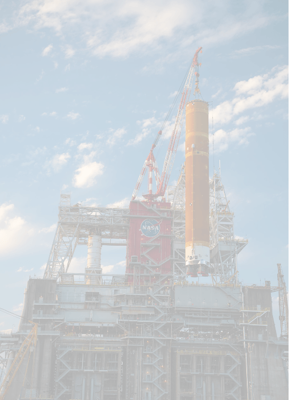
 (MsET)
at
Stennis. Since
1994, MsET has provided office
space and business services to large and small technology-based
companies, particularly
those developing geospatial technologies. WorldWinds has steadily grown
its business
over the years, but the real value of their services, according to
Valenti, are
being proven since Hurricane Katrina.
During a 2003
NASA
Small Business Innovation Research (SBIR) project, WorldWinds bought a
copy of
a license of the ADCIRC, a hydrology model that simulates storm surge. The company went to great
lengths to learn to
use the model and purchased a LINUX cluster, which is essentially a
mini supercomputer,
to run the model. This
one step is
proving to put WorldWinds in the proverbial cat-bird seat. “Right now, we
are one of only a small
handful of others that run ADCIRC in house and commercially,”
she said. “Nobody
else in this area does what we
do.”
Partially
because
of this capability, WorldWinds secured two contracts from URS, a civil
engineering firm out of Baton Rouge,
La.
On the Maurepas
Project, URS
partners with
the Louisiana Department of Natural Resources (DNR), the Environmental
Protection Agency and the Army Corps
of Engineers to study an area southwest of Lake Maurepas near New Orleans, La., as part of Louisiana’s coastal restoration.
DNR and the Corps of Engineers are
considering construction of a diversion between the Mississippi River and the surrounding
swamp in the study area to determine how the land will be built up. WorldWinds is simulating
various water flow scenarios for the
project using its ADCIRC capability.
As
a kudo to WorldWinds, the developers of the ADCIRC model actually
passed when
approached by DNR to do the work and recommended WorldWinds.
Having proven themselves, DNR
hired WorldWinds to create storm surge simulations for the Mississippi
River
Gulf Outlet, which is a shipping channel trenched through St. Bernard
Parish, Louisiana. “This
outlet has been the subject of a lot
controversy in the Parish, because it has caused a tremendous amount of
erosion,” Valenti said.
Once Hurricane Katrina hit,
the Outlet area has been under much speculation in its contribution to St. Bernard and
New Orleans
levee breaks and
flooding. “The
Parish has blamed the
Outlet as a major contributor to the flooding,” Valenti said.
“But our
models show that the Outlet really
had very little impact. The water actually came up over
the marsh land to breach the levees.”
WorldWinds
has provided this information to
the St. Bernard Parish Council. “At first they were
surprised. But as we showed
them the information, they became receptive. Their question was,
‘Well, what’s
our next step?’” Valenti said.
WorldWinds suggested that more in-depth studies need to be
done
concerning coastal erosion and salinity intrusion into the local marsh.
While WorldWinds’ ADCIRC
in-house capabilities are attracting business for the company, they
might prove
invaluable to victims of Hurricane Katrina. The
company is contracted by AccuWeather
to generate wind-speed and flood-level time series plots for areas on
the Mississippi
Gulf Coast
and in Louisiana. AccuWeather
is the largest weather product provider in the United
States. Its
in-depth forensics department provides
for-hire expert witnesses and legal testimony for people who are taking
insurance companies to court.
AccuWeather provided latitude
and longitude positions for 50 specific houses in Mississippi and Louisiana. The
time-series plots developed by WorldWinds
show wind speed and water levels on an hour-by-hour basis for specific
areas. For example,
in Bay St. Louis,
MS, the WorldWinds plots indicate the city was ravaged by 120+ mph
winds for 4
½ - 5 hours before water levels reached their highest --
winds strong and long
enough to do significant structural damage. The
company is using the WorldWinds
time-series plots as part of its legal testimonies. WorldWinds
personnel have also attended
mediation with insurance companies and provided this information.
WorldWinds will provide this
information for Hurricane Katrina victims free of charge. For more information on
the time-series
plots, contact evalenti@worldwindsinc.com.
Valenti anticipates work with
additional Federal agencies involved in hurricane recovery efforts.
“My family
lost 9 houses to
Katrina, so this work is very personal to me,” Valenti said.
“I hope we can
help many other people in the community.”
For more
information on WorldWinds,
contact Elizabeth Valenti at evalenti@worldwindsinc.com. For
more information on MsET, call
1-800-448-8812 or visit www.mset.org.
WorldWinds produced time-series plots for 50 specific residences along
the Mississippi Gulf Coast and in Louisiana. In Bay St. Louis, for
example, the plot shows that winds reached speeds of 120+ m.p.h. for
almost 5 hours before water levels reached their highest -- long enough
to do significant structural damage. This type of information is
available from WorldWinds to residents affected by Hurricane Katrina.